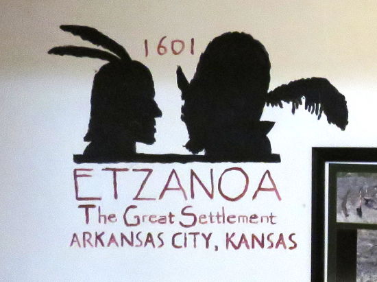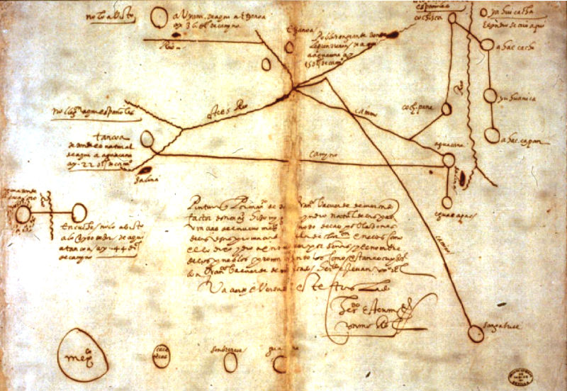
The place where evidence of the battle between the Spanish and Excanxaques was first found at Etzanoa Etzanoa, "The Great Settlement," was a large Native American city of the Wichita people that was located in present day Arkansas City, Kansas from the mid 15th Century through the mid 18th Century. Relatively little is known about this community and the location was just determined a few years ago, after researchers finally resolved a 1601 map with the local rivers and terrain. Part of the confusion came from the top of the map being East, rather than North. The Wichita people were a group of Native American tribes in the southern plains and are federally recognized today as the Wichita and Affiliated Tribes. Most of what is known about the life of the Wichita people during the period of early contact with Europeans, comes from the explorer Francisco Vásquez de Coronado who found several Wichita Cities in Rice and McPherson Counties and lived in one for a few weeks in 1541, while recovering from an injury. Their communities were made of cone shaped thatched grass lodges and unlike many Native Americans. The Wichita grew corn, beans, and melons for themselves and to trade with other Indian nations. The only contemporary documentation of the city of Etzanoa comes from papers from a 1601 expedition led by Spanish conquistador & explorer Juan de Oñate. Oñate was the Governor of New Mexico and brought 130 Spanish soldiers, 12 Franciscan priests, and 130 American Indian soldiers and servants eastward looking for Quivira, the "City of Gold." The expedition met Apaches and then Excanxaques before arriving in Kansas. The explorers were greeted in peace and with gifts by a small party from the city, but the Excanxaques (who were their enemies) had told Oñate that he would be attacked by these people and he took 4 men who greeted his party captive as hostages. It was later learned that one of the hostages was the Chief. The people of the city, whom the explorers called the Rayados, responded by fleeing Etzanoa to the north and when the Spanish crossed the river to the city, they found it empty. The city had many thatched houses which were clustered in groups with farmed land between them, which combined with the irregular terrain to make it difficult for the heavily laden exploration party to move through the city. Oñate made a camp, sending out an exploring party to investigate the city. In three days, they did not find the northern boundaries of the city, but became concerned about being attacked and returned without completing their exploration of the city. In the portion they saw, they counted 2,000 large thatched homes with 10-12 beds per home, evidence of a community of at least 20,000 people. With large numbers of Native Americans north and south of them, the expedition turned south to return to New Mexico. While still at the edge of Etzanoa, they were ambushed by a large party of Excanxaques who had followed them. The Spanish had cannons and muskets, but the Excanxaques understood the terrain and the 3 hour battle was inconclusive. The Spanish took 3 men prisoner and these prisoners returned to New Mexico with them. One of them was a young man named Miguel, who later drew the map of Etzanoa shown below. The name of the city comes from this map.
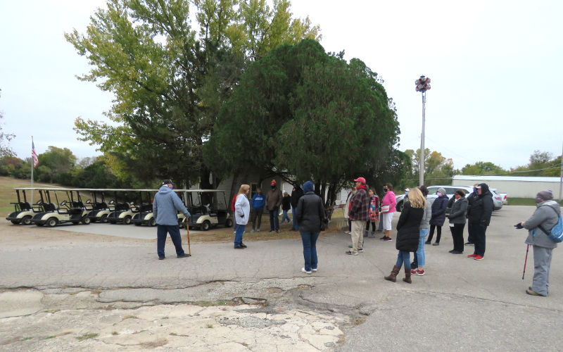
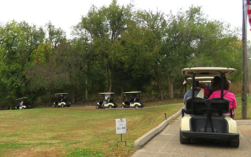
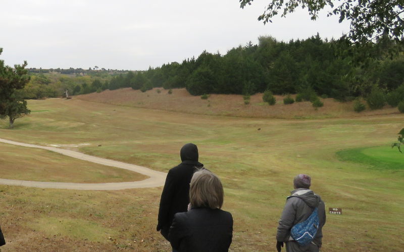
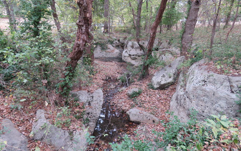
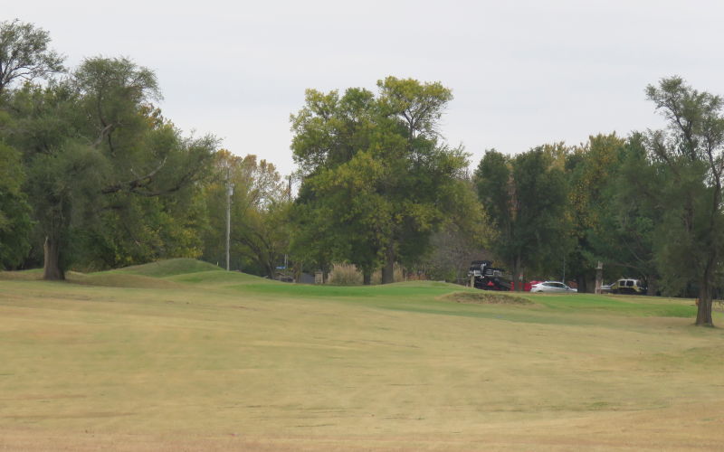
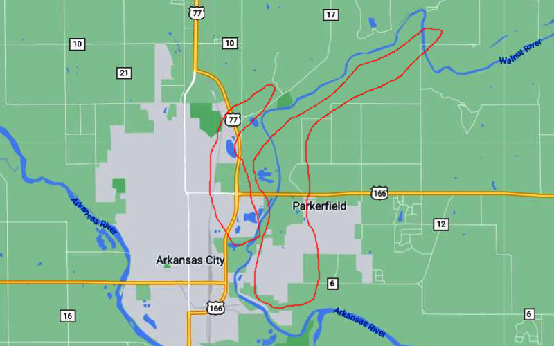
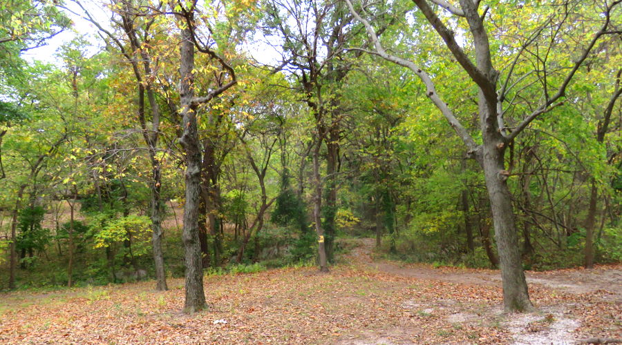
Tours of Etzanoa Etzanoa tours are conducted by the director of the Cherokee Strip Land Rush Museum the 1st Saturdays of the month in August, September & October at 10 AM. The $10 tour we joined in 2020 started with a presentation at the museum and the showing of a documentary which was produced by The Archaeology Channel for the Etzanoa Conservancy. Then we caravanned to some locations in the community. It is all quite interesting, although there really isn't much to see from the time that the people lived here. I recommend parking where it is easy to join the caravan near the front, as it felt like vehicles near the back could be separated and unable to continue the tour. The first stop was at Spring Hill Golf Course where we drove golf carts to the back of the course to look out from a high point. This part was pretty cool, but unfortunately we didn't end up where the leader had planned and didn't see exactly what was intended. The next stop was more interesting as we visited a ravine where the first evidence that the Spanish had visited this area was found and where there was a small battle in 1601 between the Spanish and the Excanxaques from what is now Oklahoma. The final stop of the tour was at Arkansas City Country Club where two Etzanoa production mounds remain and there were originally 10 or more. The entire presentation and tour took about 3 1/2 hours. Today's tours are estimated to take about 2 1/2 hours. Book Now.
Etzanoa Conservancy
website
Copyright 2020-2026 by Keith Stokes |